


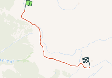


10.7 km | 13.4 km-effort


User


FREE GPS app for hiking
 SityTrail
IGN / Geographical institutes
SityTrail World
The world is yours!
Trail Snowshoes of 2.4 km to be discovered at Valais/Wallis, Entremont, Val de Bagnes. This trail is proposed by verbier.
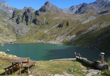
Itinéraire très facile accessible à toute la famille qui offre une vue incomparable sur la vallée de Bagnes et le massif des Combins. En cas de fatigue, possibilité de prendre les télécabines «la Chaux Express».
Remarque: Les chiens de traineau empruntent la même route que les randonneurs. Pour éviter tout danger de collision, les randonneurs sont invités à tenir leur droite.

On foot
On foot
On foot

Walking

On foot
On foot

Walking

Walking
Walking